Thursday 22nd May 2025
The sun had finally sunk over the horizon in an orange glow at around 21.30 last night as I was slurping my way through fish pie. However, this morning, low cloud obscured the marvellous views. We were both awake before the alarm beeped at 07.30 and we made tea. I couldn’t resist another quick blast in the shower with the ylang ylang scented shower gel and body lotion. I stretched by performing a salute to where the sun should be, and inspected the damage to my feet. A huge blister covered my entire left heel. I padded it with 2 blister plasters and hoped for the best. The blister on the ball of Nye’s left foot had filled with fluid too. We dressed in our walking clothes and limped down to breakfast in sandals.
I can thoroughly recommend the Pheasant Inn’s breakfast. We were both tempted by the Vegan full English but didn’t fancy the black pudding, even if it was blood-free, so ordered smoked salmon omelette with wholemeal toast. To start with, we helped ourselves from the buffet of granola, berries, dried fruit and yoghurt and Nye snuck in a pain au chocolat too.
“Do you prefer walking in sun or rain?” asked one of the two young women on duty, as we checked out.
“Sun” we said in unison.
“Really,” said our hostess. “If I was a walker, I think I’d definitely prefer the rain. Weren’t you roasting yesterday?”
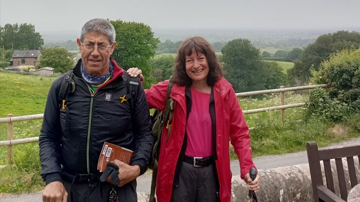
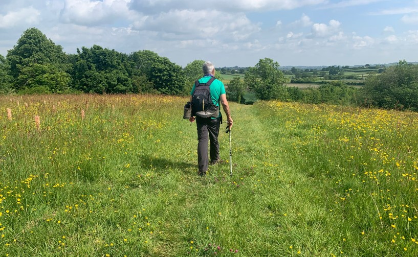
Yesterday had been gloriously sunlit throughout with a top temperature of about 20 degrees. I fail to understand how many Brits deem this to be boiling hot. I am the kind of person who huddles in a fleece when many are stripped down to strappy tops. We posed for a team shot on the murky terrace. It started to drizzle as we left The Pheasant and a few seconds later my mobile rang so we had to stop and wrestle around in my backpack to locate it. It was the nurse in charge of discharging my father from hospital to a nursing home. By the time I’d finished, it was nearly 10.00. We weren’t really too bothered by the late start as, judging from the map and the amount we had covered yesterday, today’s walk should be much shorter.
We faffed around for a bit trying to work out our way back to the Trail and made one brief false start before picking up the way markers by the inevitable kissing gate. The promised signpost welcoming us to the Borough of Crewe and Nantwich was missing. The rain stopped and we followed a pretty path between trees and paddocks to Bulkeley Woods. The guide’s instructions were a bit confusing at this point. The ‘picturesque sandstone gatehouse’ mentioned was there OK but the signposts to Bulkeley Hill and Rawhead were not.
“’Ignore the precipitous track ahead,’” I read from the book. “How can anything around here be precipitous when the highest point of the trail is 227m above sea level?”
“Do you know where you’re going?”
We turned to see a middle-aged fleece-clad couple with an enormous sand-coloured dog.
“Not really,” said Nye. “Are you local? And is that a Rhodesian Ridgeback?” He pointed to the dog who came and lay his magnificent head against Nye’s thigh.
“Wow! I’m impressed you know the breed. His name is Rio, after the Rio Olympics as our daughter is a rower and she won a silver medal there.”
They directed us through the woods up a slope far more precipitous than the track we were supposed to ignore. This bit of the Trail was really lovely as we were climbing a huge sandstone escarpment with sweeping views over the Cheshire plain. Nye moaned about his painful feet from time to time. Mine were hurting too, but I was enjoying the views and the fresh smells of damp moss and ferns so I tried to ignore the pains and concentrate on the pleasures. We left the National Trust woodland, passing some more dog walkers and emerged onto a track/lane with an information board and a milestone telling us it was 33km to Frodsham and 22km to Whitchurch. Since Nye’s watch claimed we had already walked 37km since Frodsham, this struck us as a bit unfair. 22km sounded a long way still to go on our blistered feet.
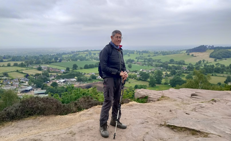
Our next intermediate goal was Rawhead, the highest point of the Sandstone Trail at 227m. As we climbed, the trees thinned out in places to give glimpses of Beeston and Peckforton Castles rising from their forested ridges. The guide advised us that there were several caves worth exploring in this area but, alas, we were making slow progress on our painful feet and could afford no deviations even if those caves had been painted like Lascaux. We paused at a huge sandstone block known as ‘the Moving Rock’ as it has crept a few centimetres down the cliff over the past few decades. We stood on a large rocky platform to gaze over the valley to the ridges we’d walked across yesterday and beyond. We ate a few nuts and slurped from our water bottles. We continued to a white-painted trig point at Rawhead and imagined that our route must be all downhill from now. Not that we had found any of the climbs particularly challenging, but our feet protested at every step and we needed some straight, flat paths so we could cover the next few kilometres more rapidly.
We heard voices and moved to the side of the track to let a whole bunch of walkers pass in the opposite direction. They didn’t have backpacks and looked like a rambling club. Most sported T-shirt souvenirs of previous exotic adventures. ‘Antarctica’ proclaimed one of them above stencils of icebergs.
“You have to be stinking rich to go to Antarctica” remarked Nye.
“Well I’ll never get there then, but I don’t want to go anyway. I hate the cold. The nearest I’ll get to Antarctica is the penguin enclosure at Chester Zoo.”
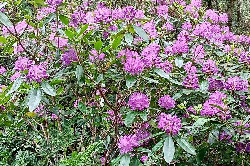
“’Continue above Rhododendron-infested Coombe Dale,’” I read from the guide book. “How can anyone use the word ‘infested’ to describe such beauty?” The hollow below us was ablaze with the bright blooms, enlivening the gloomy morning with their flamboyant day-glow mauve. I remember old friends volunteering for the National Trust and being tasked with hacking out rhododendrons for being a non-native species. Yet they are such magnificent flowers. I feel they are unfairly maligned.
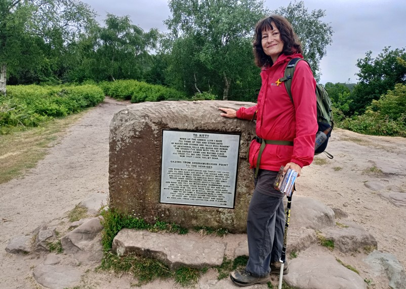
We skirted through the village of Bickerton, passing its church made of sandstone (what else?) and climbed up to Kitty’s Stone, a moving memorial to a departed love. We paused for more nuts, dried apricots, and water at the site of Maiden Castle, an Iron Age hill fort. The gloom was lifting and I removed a layer of clothing. As we were crossing the flatter farmland beyond the Bickerton Hills, the sun came out. We crossed the grounds of a racing stable, complete with a practice track known as ‘the Gallops’. Sadly, no horses were thundering around when we passed. Half way down a hedge-lined track called Shay Lane, Nye decided he could stand his painful boots no longer. He sat in the middle of the track, yanked them off cursing and delved into his pack for his walking sandals. He tied the boots to his pack.
“That’s still painful, but bearable,” he concluded.
I stripped down to my T-shirt while he did this. It was 14.00 and my sumptuous breakfast had long worn off.
“I hope we can find somewhere for a cup of tea and a scone or sandwich.”
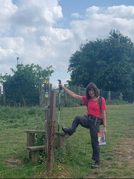
So far today, our walk had taken us through blissfully rural landscapes with no food and drink possibilities whatsoever. It must be quite difficult even for those with a back-up vehicle to arrange a place to meet up with supplies as much of the trail is well off-road. We crossed more fields and unlatched countless kissing gates. The guidebook mentioned a sign to Grindley Brook and Whitchurch but this failed to materialise. Around the place where it was supposed to be, we encountered our only other long-distance walkers – a couple a bit younger than us who had set off from Whitchurch today and were going all the way to Frodsham tomorrow after spending the night at ‘The Bickerton Poacher’. We compared observations on the Trail so far and they warned us that the first potential tea stop was on the outskirts of Whitchurch. There was a little shop in No Man’s Heath, a short distance ahead, but diverting for supplies would add 2km to our journey so we decided to stick to our nuts. They warned us that the field ahead was a bit boggy so we snuck through a gap in the hedge to circumnavigate the wet bit.
Directions became a bit vague again and led to a nettle infested footbridge that led to a track that doubled back to where we had started. We had to climb a gate to access the path through Bar Hill farm yard and the track was patrolled by a large black cow. We skirted round her tentatively and encountered a farmer emerging from a barn.
“The Sandstone Trail…that’s miles from here,” he told us, his grin betraying him. “Go through the gate to your left.”
Shortly after this, we encountered probable farmer sabotage of the path. The guidebook indicated that we should go through yet another kissing gate and follow the edge of a vast undulating field to a waymarked kissing gate in the hedge opposite. The first kissing gate bore the usual Sandstone Trail sign pointing in the correct direction but when we reached the far side several minutes later there was no hedge, no kissing gate and no way marker. Instead there was a lopsided fence enmeshed in layers of barbed wire. Cursing, I hobbled back down the massive field to check the initial way marker while Nye edged his way through boggy ground at the top of the field in search of an alternative gate. The first way mark was correct, as I had known it would be. We met up, Nye with wet feet having trodden in the bog. I blubbed and cursed whichever farmer had done this and Nye fiddled with his phone to try and establish our exact position. I was getting annoyed as I was pretty sure I knew our exact position. We wasted about 30 minutes in total: arguing, checking maps, trying to get a GPS signal to recheck the route, finding a compass and coming up with an alternative plan. Nye suggested heading for the A49, a country mile or so to our east. I wanted to climb over the fence and follow the directions the other side. If we came to a chapel called St Chad’s we would know we were on the right path. We ended up doing this but it took ages trying to avoid being lacerated by the barbed wire. Nye held it down while I tried to wedge my feet between the rungs of the fence and edged my way to the far side without impaling myself. Nye had the bright idea of wedging his backpack on top of the worst of the wire to cushion his tender crotch from it. Once safely over, we followed directions along the hedgerow and came to a kissing gate exactly where it should be, with a way marker. Ahead loomed St Chad’s chapel, at the other side of a field. The waymark and directions pointed diagonally across this field, which the farmer had kindly ploughed over and planted with what looked like sweetcorn. I kicked at the emerging plants in a rage as we crossed, following traces of boot prints. Why do some farmers think they can sabotage a public right of way on a well-trodden long-distance footpath?
We passed the site of another missing signpost and crossed some more fields to emerge next to the Llangollen Canal at Wileymoor Lock. I spotted a white-painted canal side pub. “Hallelujah! Let’s stop for a drink and a sandwich.” Alas, the pub was closed. It was 17.30 and it opened at 18.00. We could not really afford to wait that long so settled at one of the wooden tables to chomp on yet more nuts and dried apricots and have another swig of water. I took my boots off for a few minutes and wiggled my weary toes. The blister on my heel felt tender and enormous beneath its protective layers of Compeed.
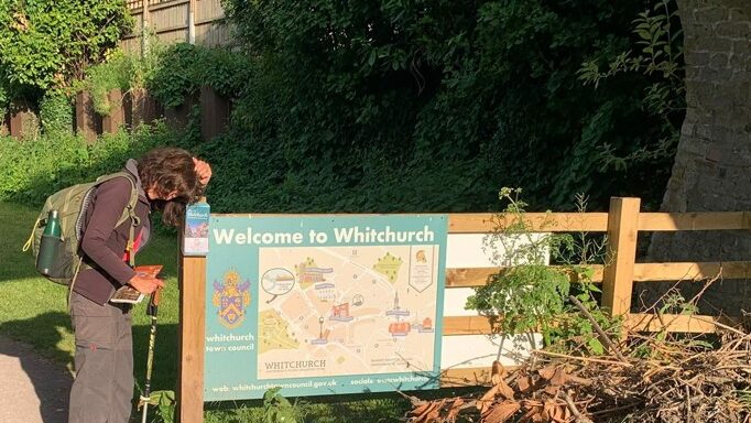
The final stage along the Llangollen Canal was glorious and we would have really enjoyed it had our poor feet been in less pain. The towpath was flat and nettle free and the sun shone through the leaf canopy. We passed painted barges and pretty cottages, and as we now just followed the canal for 5.5km into Whitchurch, navigation was easy. However, every step on our throbbing feet was agony.
Nye was a few steps ahead.
“Hello,” I heard him call.
I turned towards the hedge to see who he was talking to and saw a middle-aged man clutching a pair of trousers to his crotch.
“Are you hiding?” asked Nye.
The trouser clutcher nodded sheepishly. It was then that the smell hit us.
We both burst out laughing as we scuttled away as fast as our wounded feet would carry us.
“Oh my god! He was having a crap in the hedge.”
As we recovered from semi-hysterics on a bench a little further on, I realised it was 18.30. I has originally envisaged catching the 17.38 train from Whitchurch to Wrexham. Now it looked as if we would miss the 18.38. Nye pulled his phone from his pocket to check if there was a 19.38, while I wondered about catching an even later train and trying to find something to eat. I was weak with hunger and a cold beer would not have gone amiss.
Lucky we checked. All trains along the Welsh borders line were cancelled as a train had collided with a tractor some careless farmer had driven onto a level crossing at an inopportune moment. Luckily no-one was hurt, but that meant our efforts to rely on leg power and public transport were scuppered. It looked as though the Crawl across the Word team would have to break a rule and call the cavalry in. My brother, Nick lives half an hour’s drive away and had kindly offered to come to our rescue should the weather turn vile, our legs give up or if we simply wanted to wimp out. Well, we had made it to the end so I guess that made our need for Nick’s rescue services less embarrassing. I called him and we arranged to meet in Tesco’s car park in Whitchurch in half an hour.
For the last km, the Trail crosses a lift bridge (which was raised while a barge passed beneath) and runs along a branch of the canal into Whitchurch. Waterside pubs were packed with people enjoying cold drinks in the evening sunshine. We staggered on past them and asked a dog walker directions to the town centre and Tesco’s.
“It’s only about 5 minutes,” he assured us.
“Even at cripples’ rate?” I asked.
So glad to see Nick’s car pull up as we sat on a low wall outside the supermarket. Half an hour later, we hobbled across my father’s front lawn in our bare feet, leaning on our trekking poles. All three of us were laughing our heads off.
“At least we have Dad’s stair lift,” I giggled. “We may need to make use of it to get ourselves to bed tonight.”
Stats for the day
- Km walked: 28
- Steps: 40,000
- Floors climbed: 520
- Activity minutes: 99 (That’s got to be wrong. We might have been slower than yesterday but we walked for 9 hours).
Tips
The Crawl across the World Team recommends that, however warm the weather, you do this walk in long trousers as protection from the many vicious stinging nettles.
There are lots of ups and downs but none are particularly steep. The ratio of wonderful scenery for effort makes this walk well worthwhile. The only difficulty is the distance. We often walk 20km per day but found ourselves flagging beyond that. We were carrying daypacks weighing about 6kg each, about twice as much as on our day walks. Even that weight makes a difference to the impact on your feet.
Lack of food and drink was a problem on Day 2. Carry lots of lightweight but high-energy snacks and plenty of water.
Leave a Reply